The USGS Hawaiian Volcano Observatory was unable to issue Volcano Watch by its regular Thursday deadline on May 3 due to unfolding events on Kilauea Volcano. Little did we know that Friday would be even more hectic.
How it began
Following a collapse of the Pu‘u ‘O‘o crater floor on Monday, April 30, an intrusion of magma migrated down Kilauea’s East Rift Zone, advancing below ground toward Highway 130 and communities in the lower Puna District on Hawaii Island. The possibility that the intrusion would lead to an eruption of lava became more likely as numerous small earthquakes shook the area over the next few days.
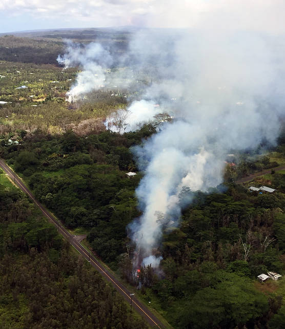
On Thursday, May 3, it happened. With little fanfare, steaming ground cracks were soon spewing lava in Leilani Estates.
By Friday morning, three additional fissures had opened in the subdivision, with lava traveling less than a few tens of meters from the vents.
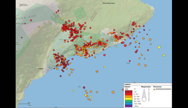
Then, Kilauea really started rocking and rolling. It began with a magnitude-5.4 earthquake at 11:32 a.m. An hour later, a magnitude-6.9 earthquake, the strongest quake to strike Hawaii since 1975, rattled residents across the island and beyond, with felt reports from as far away as Kauai. Over the next 24 hours, more than 500 earthquakes — 13 with magnitudes of 4 or greater — shook the island.
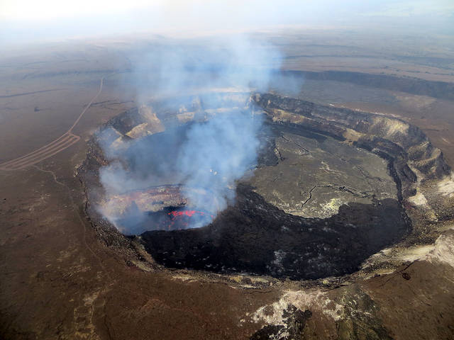
In the meantime, the summit of Kilauea switched from inflation to deflation, and in concert with that deflation, the summit lava lake level began to drop.
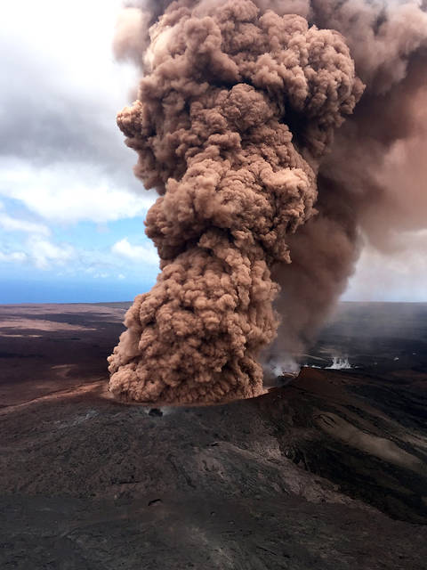
Events of this notable day on Kilauea are summarized in a photo essay featuring images from Friday.
Volcano Activity Updates
This past week, Kilauea Volcano’s summit lava lake level dropped with summit deflation, and was about 160 m (525 ft) below the vent rim as of Saturday at 9:30 p.m. On the East Rift Zone, the 61g lava flow is no longer active. Episode 62 commenced on Kilauea’s lower East Rift Zone on May 3, with at least 10 fissures (as of Sunday) opening within the Leilani Estates subdivision in the lower Puna District. Both eruptions, summit and East Rift Zone, are dynamic, and additional changes will be reported on HVO’s website at https://volcanoes.usgs.gov/volcanoes/Kilauea/status.html.
Mauna Loa is not erupting. Rates of deformation and seismicity have not changed significantly over the past week.
More than 100 earthquakes were reported felt in Hawaii during the past week. The largest of these earthquakes was a magnitude-6.9 event located about 16 km (10 mi) southwest of Leilani Estates on Big Island at a depth of 5.0 km (3.1 mi). It occurred at 12:32 p.m. on Friday, and was one of 14 earthquakes with magnitudes of 4.0 or greater to occur that day.
Please visit HVO’s website (https://volcanoes.usgs.gov/hvo) for past Volcano Watch articles, Kilauea daily eruption updates, Mauna Loa weekly updates, volcano photos, maps, recent earthquake info, and more. Call for summary updates at 967-8862 (Kilauea) or 967-8866 (Mauna Loa). Email questions to askHVO@usgs.gov.
Volcano Watch (https://volcanoes.usgs.gov/hvo/hvo_volcano_watch.html) is a weekly article and activity update written by U.S. Geological Survey Hawaiian Volcano Observatory scientists and affiliates.