Forecasters keeping eye on Tropical Storm Irwin, unnamed disturbance
Yet another named tropical cyclone is lurking in the Eastern Pacific and moving toward the Central Pacific Basin.
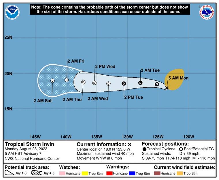
At 5 a.m. today, the center of Tropical Storm Irwin was about 2,060 miles east of Hilo.
ADVERTISING
Irwin is packing maximum sustained winds of 40 mph with higher gusts, and is moving to the west-northwest at 8 mph. A turn toward the west is expected shortly and this motion is expected to continue for the next few days.
Gradual weakening is expected over the next day or so, and Irwin is forecast to become a remnant low by Wednesday, if not sooner.
Irwin is a large storm, and tropical-storm-force winds extend outward up to 255 miles from the center.
Meanwhile, an unnamed tropical disturbance is brewing in the Central Pacific, about 900 miles southeast of Hilo.
The low-pressure system is producing disorganized showers and thunderstorms.
Environmental conditions are marginally conducive for some slow development of this system over the next few days. It’s moving to the west at 10 to 15 mph, and forecasters estimate a 20% chance of its organization into a tropical cyclone in the next 48 hours.
