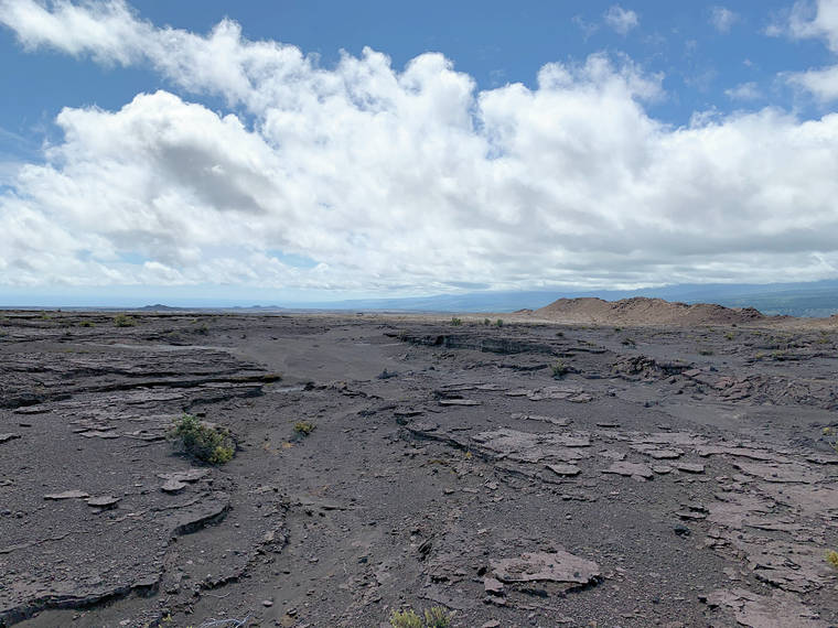
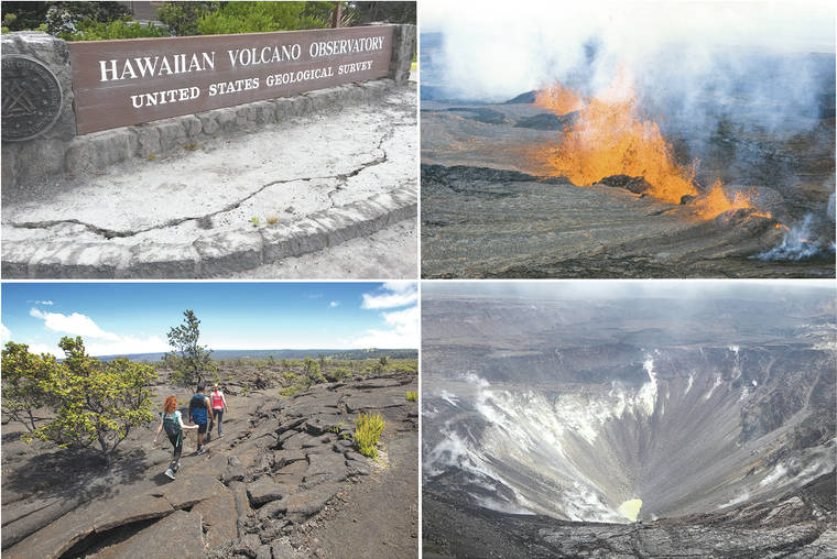
Volcano Watch: Kilauea’s other rift zone; young activity in the Southwest Rift Zone
It is no secret that the Island of Hawaii is home to fantastic volcanic features, many of which have been created during eruptions of Kilauea, Mauna Loa and Hualalai since 1800.
Volcano Watch: Words matter — lava, not fire, but island or raft or basalt berg?
Words matter in volcanology just as in the rest of society.
Volcano Watch: A new eruption and new era at Kilauea Volcano
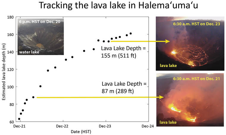
‘Twas the Sunday before Christmas, the eve of the winter solstice, and festive holiday lights blinked of bright red and green. And then, shortly after 9:30 p.m. on Dec. 20, so did the Hawaiian Volcano Observatory’s volcano alert level/aviation color codes for Kilauea!
Volcano Watch: How has topography been modeled at Hawaii’s volcanoes?
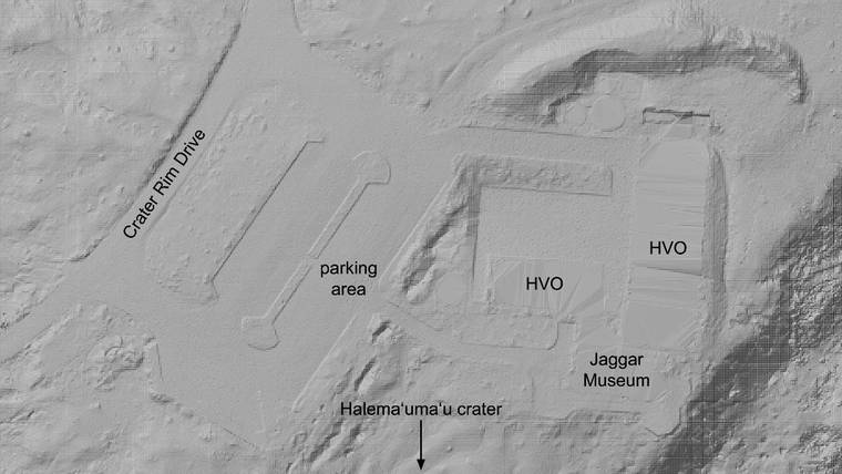
In cartography and geographic analyses related to volcanoes, especially in Hawaii, there is perhaps nothing more important than having an accurate digital model of topography. Such models depict the three-dimensional nature of the land, elucidating features from past eruptions and influencing potential pathways of future activity.
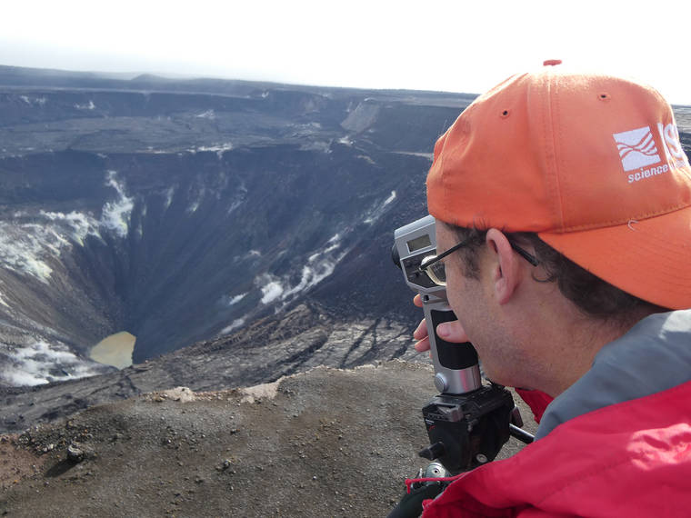
Volcano Watch: Innovative monitoring of Kilauea’s summit water lake
Famous for glowing red lava and billowing volcanic plumes, Halema‘uma‘u has long inspired poets, painters and photographers to find meaning in the color and light of this dynamic landscape.
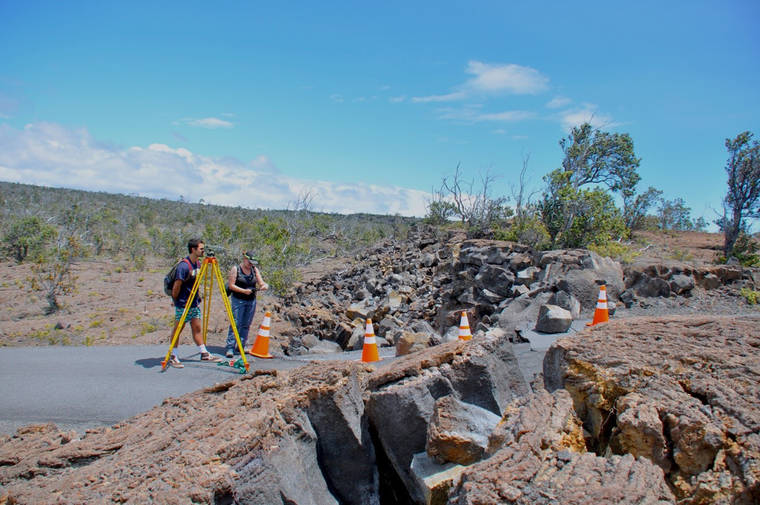
Crack team of geologists measure the Koa‘e fault system
The Koa‘e fault system connects Kilauea’s East and Southwest rift zones south of the caldera. Faults here appear as low cliffs, or “scarps,” along Hilina Pali Road in Hawaii Volcanoes National Park. These fault-cliffs slip during major earthquakes, such as those of May 4, 2018 — near the beginning of Kilauea’s 2018 eruption.
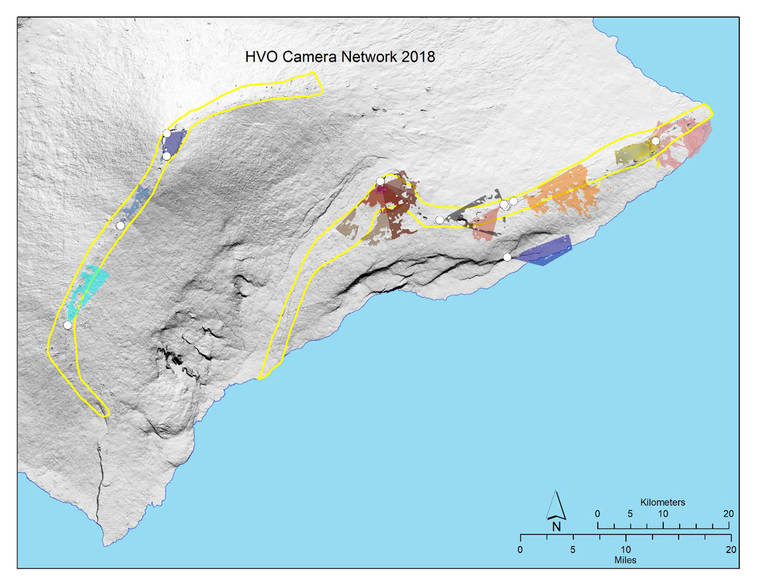
Volcano Watch: HVO camera network reconfiguration and upgrades coming soon
Throughout the past two decades, the USGS Hawaiian Volcano Observatory has set up a camera network system to monitor visual changes at Kilauea and Mauna Loa volcanoes. This network was designed for the volcanic activity of the time and captured the two long-lived eruptions of Kilauea at the summit and East Rift Zone up close.
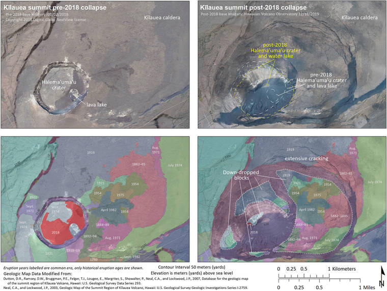
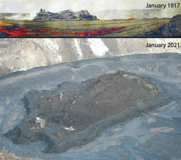
Volcano Watch: On the surface of Kilauea’s new landscape, a story is told
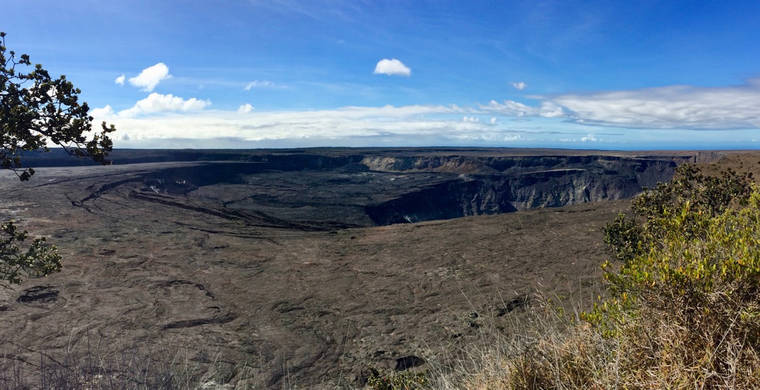
Kilauea’s 2018 summit collapse dramatically transformed the geometry and appearance of Halema‘uma‘u crater and Kilauea caldera.
Volcano Watch: Underneath Kilauea’s new landscape, the magma plumbing keeps working
Last week, Hawaii Volcanoes National Park was able to open the Kilauea Overlook to the public for the first time since the lower East Rift Zone eruption and summit collapse in 2018. The viewing location offers a new perspective on the breathtaking summit collapse structures and the major changes those collapses had on Kilauea’s landscape.
Volcano Watch: Tech talk part 2 — Schematic diagram of one HVO technician’s position
Last week’s “Volcano Watch” article introduced the role of “technician” at the USGS Hawaiian Volcano Observatory. This week, we present the introspective of Steven Fuke’s life (schematic diagram) as an electronics technician at HVO through his experiences, starting with his introduction to HVO.
Volcano Watch: HVO looks to the past to better understand future Mauna Loa eruptions
Mauna Loa, the largest active volcano on Earth, has erupted, on average, every 5-6 years during the past 3,000 years.
Volcano Watch: Danish postdoctoral fellow helps HVO understand Kilauea’s explosive eruptions
Kilauea Volcano attracts researchers from around the world. Johanne “Jo” Schmith joined the ranks of the US Geological Survey’s Hawaiian Volcano Observatory in June to study some deposits of past Kilauea explosions — a timely endeavor given the presence of water in the caldera today.
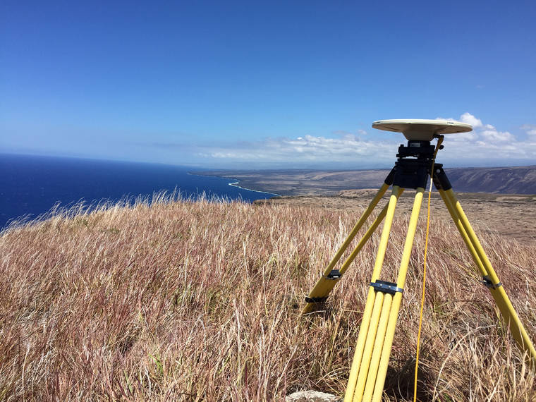
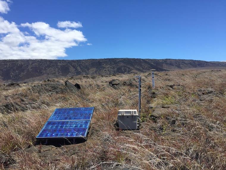
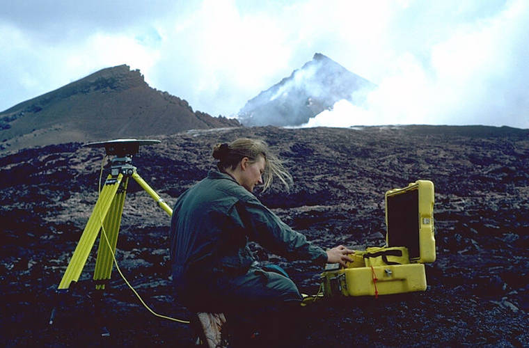
Volcano Watch: An important point — Measuring the volcano’s shape with high precision GNSS
When you think of GPS, what typically comes to mind? Your phone, the navigation in your car or maybe your watch?
Volcano Watch: HVO announces Volcano Awareness Month programs for January 2020
Neither Kilauea nor Mauna Loa erupted in 2019, but this period of relative quiet must not lead to complacency about Hawaii’s two most active volcanoes. Both will eventually erupt again.
Volcano Watch: Honoring the career and contributions of an HVO shining star
On March 30, 2018, a change occurred within the ranks of the USGS Hawaiian Volcano Observatory’s staff when geophysicist Asta Miklius retired. One month later, a collapse at Pu‘u ‘O‘o heralded the start of Kilauea Volcano’s lower East Rift Zone eruption and summit collapses.
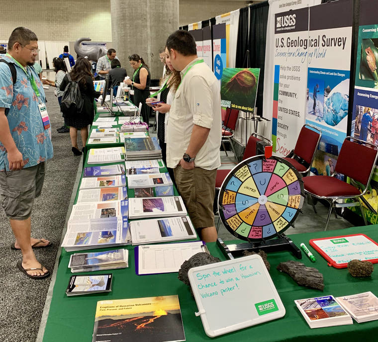
Volcano Watch: HVO scientists mentor STEM students at national conference
About a month ago, I attended the 2019 National Diversity in STEM Conference, an annual meeting organized by the Society for Advancement of Chicanos/Hispanics and Native Americans in Science, put on in Honolulu this year.
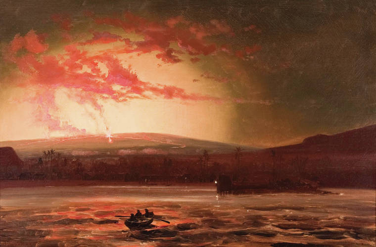
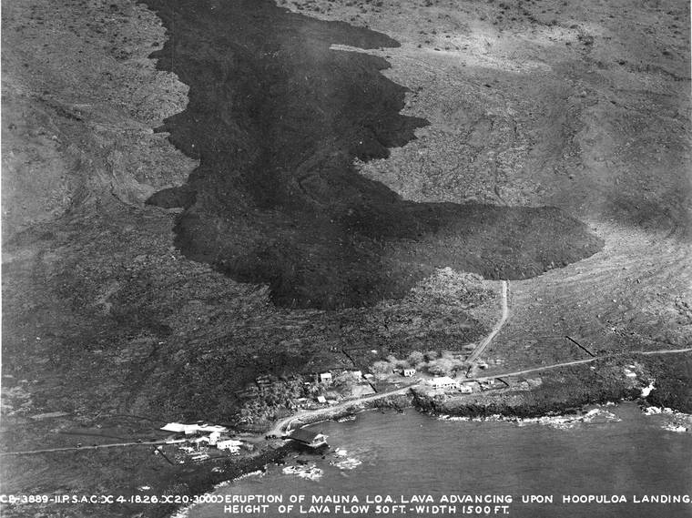
Volcano Watch: Hilo had a close call from the 1881 Mauna Loa lava flow
During the past two centuries, six lava flows erupted from Mauna Loa’s Northeast Rift Zone and advanced toward Hilo.
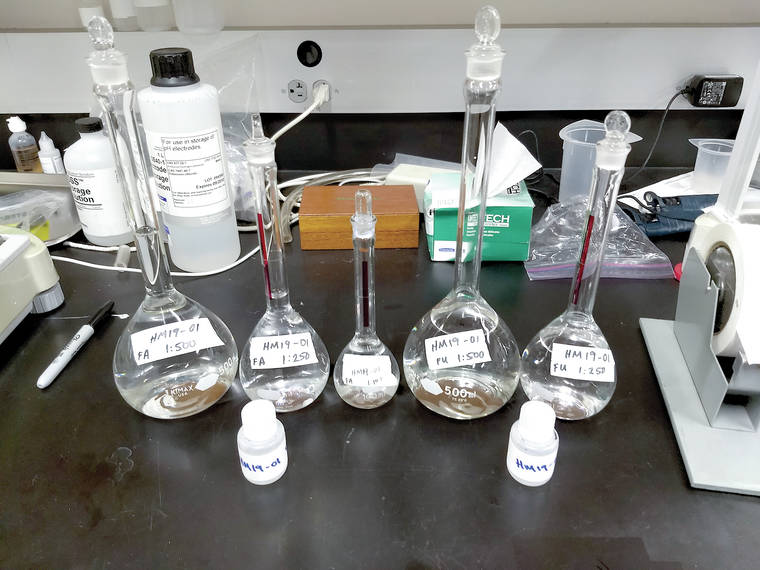
Volcano Watch: Pondering the pond — what Halema‘uma‘u water chemistry tells us
In the tradition of Hawaiian Volcano Observatory founder Thomas Jaggar’s innovative field methods, HVO recently used a cutting-edge technique to sample the Halema‘uma‘u water lake deep within Kilauea’s collapsed summit crater.
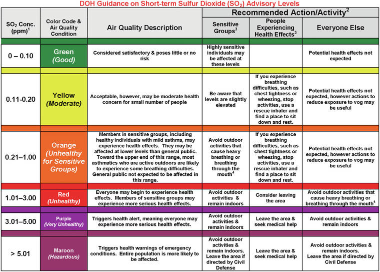
Volcano Watch: Hawaii Department of Health updates Ambient Air Quality Data website
Information about air quality is important to Hawaii residents, particularly those living on the Island of Hawaii, where volcanic activity can lead to frequently changing environmental conditions.
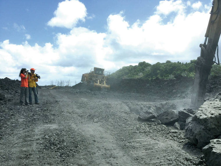
Volcano Watch: Why is the 2018 lava still so hot?
As roads are recut into Kilauea’s 2018 lava flow field, many have been surprised at how hot the lava remains under the surface, even though it is solidified.
