Continued unrest at Kilauea volcano has led Hawaii Volcanoes National Park to close more trails to the public.
According to the Hawaiian Volcano Observatory, seismic activity under Kilauea has increased again after a brief lull earlier in the week, indicating that the movement of a large volume of magma under the southern part of the caldera is continuing.
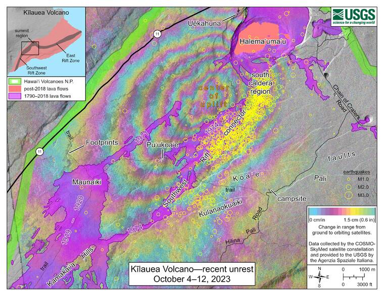
That activity began last week, with HVO concluding that an eruption of the volcano could begin at the summit with only one or two hours of warning. Although activity decreased over the weekend, it has once again increased.
On Tuesday, HVO reported detecting 136 earthquakes within 24 hours, comparable to the 134 detected within a 24-hour period one week prior.
Meanwhile, summit tiltmeters only detected very minor terrain inflation Wednesday, and levels of sulfur dioxide and other volcanic gases remain low.
In light of the elevated activity, HVNP announced Wednesday that it would close the Mauna Iki Trail and parts of the Ka‘u Desert and Footprints trails until further notice. While the Footprints exhibit at the Ka‘u Desert trailhead remains open, the trail itself is closed past that exhibit to the intersection with Mauna Iki.
Kulanaokuaiki Campground remains open to the public, as is Hilina Pali Road, although the latter is closed to vehicles beyond the campground due to an elevated fire risk.
“Safety is always our top priority, and the potential hazards in this region are significant and could include elevated volcanic gases, dangerous lava activity, and damaging earthquakes with very little notice,” said HVNP Superintendent Rhonda Loh in a statement. “After any potential eruptive activity occurs, park managers will reevaluate high hazard areas and access.”
The park previously closed several trails on Oct. 9 for similar reasons, including the same Mauna Iki and Ka‘u Desert trails, Crater Rim Trail, Keanakako‘i Overlook, Devastation Trail, Hilina Pali Road and the Kulanaokuaiki Campground. As of Wednesday, all but the first two of those trails remained open.