A tropical storm warning is in effect for the Big Island


UPDATED 5:20 p.m.
The National Weather Service has issued a tropical storm warning for Hawaii Island.
ADVERTISING
A tropical storm warning means that tropical storm conditions are expected somewhere within the warning area within 36 hours.
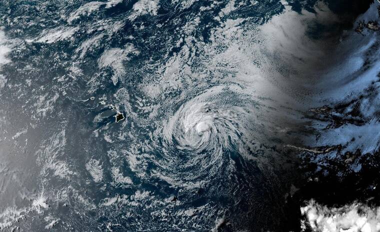
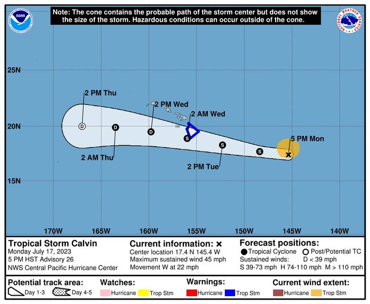
At 5 p.m. today, Calvin was about 655 miles east-southeast of Hilo and had maximum sustained winds of 45 mph, with locally higher gusts. The storm was moving west at 22 mph.
Tropical storm conditions are expected on the Big Island starting Tuesday night.
From Tuesday night into Thursday, storm rainfall of 4 to 8 inches, with maximum amounts of 10 inches, are possible, mainly along the windward areas of the Big Island. This rainfall could lead to localized flash flooding and mudslides.
Swells generated by Calvin are expected to begin reaching the main Hawaiian Islands during the next couple of days. A rapid rise in the surf is expected Tuesday and Wednesday, with life-threatening surf likely along exposed east-facing shores.
PREVIOUSLY
The National Weather Service has issued a tropical storm watch for Hawaii Island.
A tropical storm watch is issued when tropical storm force winds between 39 mph and 73 mph could impact Hawaii Island within the next 48 hours.
As of 8 a.m. today, Tropical Storm Calvin was about 850 miles east of Hilo, packing maximum sustained winds of about 50 mph with higher gusts. Tropical-storm-force winds extend outward up to 105 miles from the storm’s center.
The storm has picked up speed, moving west at about 20 mph.
Some additional weakening is forecast during the next few days.
Calvin is expected to approach the main Hawaiian Islands on Tuesday, with tropical storm conditions possible over some areas starting Tuesday night.
Due to the tropical storm watch, Civil Defense has put out the following advisories:
• Boat owners and those with shoreline property should begin preparing for possible surf impacts.
• Prepare your property for possible high surf, damaging winds, and flooding rains.
• Take this time to secure loose outdoor items prior to the onset of winds.
Stay connected to official sources of information, as you will be advised when conditions change.