Thousands take to lava viewing area as flow moves within 2 miles of highway
More than 14,000 vehicles have traversed the county’s lava viewing route since it opened last week.
The Traffic Hazard Mitigation Route, a 4.5-mile one-way stretch of Old Saddle Road from the Gilbert Kahele Recreation Area to Pu‘u Huluhulu opened last Thursday in order to reduce crowding on Daniel K. Inouye Highway. Since then, Lt. Col. Kevin Cronin, garrison commander for the Pohakuloa Training Area, said thousands of vehicles have traversed the route.
Mayor Mitch Roth said that more than 4,000 vehicles traveled the route on Saturday, more than 3,700 on Sunday and more than 2,500 on Monday. He guessed, however, that fewer people will make the trip today, due to rainy conditions impacting the visibility of the lava.
Roth reminded drivers to clean up after themselves and to drive with caution both on the route and on the main highway. He said that the biggest threat to people is not from the lava itself but from the extreme traffic conditions.
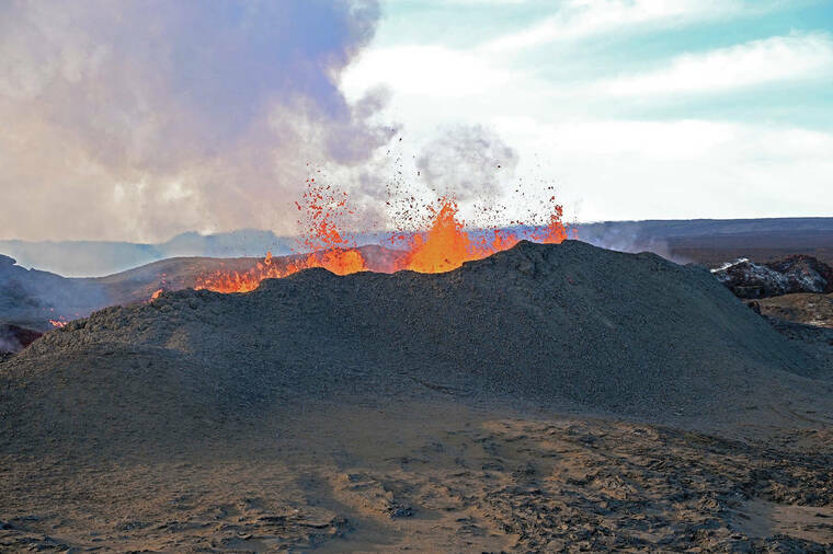
Mike Zoeller, geologist for the U.S. Geological Survey’s Hawaii Volcanoes Observatory, said the leading edge of the lava flow is now about 1.75 miles from Old Saddle Road and about 1.92 miles from Daniel K. Inouye Highway. It is advancing at approximately 20 meters per hour, but he added that it is still slowing down as it crosses the flat land on the saddle.