Darby, still a hurricane but weakening, enters the Central Pacific
Thursday, July 14, 2022 11:21 am
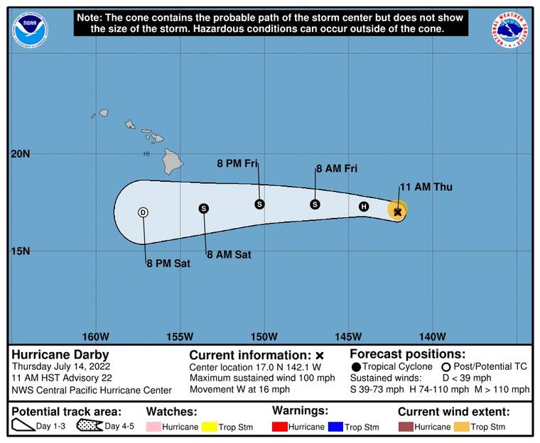
Hurricane Darby, slowly weakening, entered the Central Pacific Basin earlier today.
At 11 a.m. the category-2 hurricane was about 870 miles east of Hilo with maximum sustained winds of 100 mph. The storm is presently moving west at 16 mph.
Darby’s current projected track would bring it south of the islands on Saturday as a weak tropical storm or a tropical depression.
“The impacts that we are expecting are maybe an increase in windward showers, as well as some higher seas,” Thomas Vaughan, a forecaster at the National Weather Service in Honolulu said.
Darby is a small tropical cyclone with hurricane-force winds extending outward up to 15 miles rom the center of the storm. Tropical-storm-force winds extend outward up to 45 miles.


Get the Latest News
Subscribe to our free email newsletters for daily updates delivered to your inbox.
View all our newsletters here.
Most Popular
