The 2018 summit collapse and lower East Rift Zone eruption at Kilauea Volcano were dramatic and, for many Hawaii Island residents, tragic events. As with all eruptive crises, these events offered exceptional opportunities to learn more about how volcanoes work and to answer some “bigger picture” questions.
What is the significance of the 2018 events when viewed from the historical perspective of similar events at other volcanoes?
What impact are they likely to have on volcano science and future generations of volcanologists?
What comes next, and how might we find out?
This latest chapter in Kilauea’s remarkable story is still unfolding, but already it’s clear that 2018 marks a watershed for volcano science, not only in Hawaii but also worldwide.
Let’s explore some of the reasons why.
First, summit collapses such as the one that so profoundly reshaped Kilauea Caldera and Halema‘uma‘u earlier this year are relatively rare. At Kilauea, this was the largest summit collapse since at least 1800, and it included the strongest summit explosions since 1924. Only three comparable events occurred at basaltic volcanoes worldwide in the past 50 years. Much larger explosive events occurred in Kilauea’s past, but not since 1790, more than 200 years ago.
Other aspects of the 2018 activity also were unusual.
The magnitude-6.9 earthquake that struck Kilauea’s south flank on May 4 was the largest in Hawaii since 1975. The emission rate of sulfur dioxide gas during the main phase of the lower East Rift Zone eruption, at least 50,000 tons per day, was the highest ever measured at Kilauea. The lava production rate from fissure 8 also was unusually high for Kilauea, about three times higher than during the 1955 and 1960 lower East Rift Zone eruptions.
Such extraordinary events give scientists an opportunity to study aspects of Kilauea’s behavior first-hand, to challenge old ideas and to test new ones.
For example, based on visual observations of the 1924 explosive activity at Halema‘uma‘u, scientists thought such events were caused by the interaction of groundwater with hot rock or magma. The 2018 collapse was the most thoroughly monitored event of its kind in history, but preliminary analyses of the data haven’t turned up any evidence for groundwater involvement in the explosions.
Scientists love surprises like that because they challenge conventional wisdom and lead to better understanding.
Stay tuned.
Another head-scratcher from Kilauea’s 2018 summit collapse is that it wasn’t chaotic, as you might expect. Instead, the process that left a 500 m (1,600 ft) deep, rubble-strewn pit where Halema‘uma‘u had been was remarkably predictable.
A regular pattern emerged in which seismicity gradually built to a crescendo during a period of 1-3 days, until the caldera floor suddenly dropped several meters in a matter of seconds. The pattern repeated dozens of times from May-August. A similar pattern was recognized during summit collapse in 2000 at Miyakejima volcano in Japan.
Why would such catastrophic events follow a well-behaved pattern? Scientists love puzzles, too, and they’re already working to solve this one.
What comes next?
Following Kilauea’s collapse and explosions in May 1924, lava returned to the floor of Halema‘uma‘u during seven brief eruptions from July 1924-September 1934. The same could happen again in the coming months or years.
On the other hand, the longest period of eruptive quiescence in Kilauea’s recorded history followed from 1934-52 — with no active lava on the volcano for 18 years. So, Kilauea could stay quiet for decades.
Regardless, scientists will be probing Kilauea for signs of activity, using an array of existing tools and probably some new ones, too. They’re tinkerers on a mission, and new tools are always welcome.
The 2018 summit collapse and lower East Rift Zone eruption at Kilauea were historic events that will continue to advance our understanding of Hawaiian volcanism long into the future. As was the case at Mount St. Helens in 1980, a new generation of volcanologists endured a baptism by fire and came away excited to learn more.
In the lexicon of Hawaiian volcanology, 2018 now joins 1790 and 1924 as dates of lasting significance.
Volcano activity updates
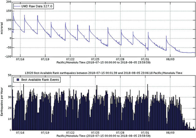
Kilauea is not erupting. Summit and East Rift Zone activity is greatly reduced, with low rates of seismicity, deformation and gas emissions recorded during the past week.
Small earthquakes at Kilauea’s summit and aftershocks of the May 4 magnitude-6.9 earthquake on the volcano’s south flank continue.
A slight inflationary trend near and east of Pu‘u ‘O‘o suggests magma might be refilling the middle East Rift Zone. Low seismicity and reduced gas emissions do not indicate the magma is shallow, but HVO continues to closely monitor this area and will report any significant changes.
Sulfur dioxide (SO2) emissions across Kilauea remain drastically reduced, with a combined rate of less than 300 tonnes/day. Small amounts of hydrogen sulfide gas (H2S) also are being released in cooler, wetter volcanic environments, and from decaying vegetation and other organic matter. The human nose is extremely sensitive to the “rotten egg” smell of H2S; some people can detect this gas at less than 0.001 parts per million. Residents reported smelling H2S downwind of Kilauea, but these concentrations are well below hazardous levels. More info can be found at ivhhn.org/information#gas.
Hazardous conditions still exist at the LERZ and summit. Residents in the lower Puna District and Kilauea summit areas should stay informed and heed Hawaii County Civil Defense closures, warnings and messages (www.hawaiicounty.gov/active-alerts).
The USGS Volcano Alert level for Mauna Loa remains at Normal. Since late September, microearthquakes have been recorded beneath upper elevations of the volcano. Because there have been no changes in deformation or gas emissions that would indicate shallowing of magma, these microearthquakes do not warrant increased concern about potential eruption. HVO continues to closely watch this seismicity and monitor the volcano for any other changes.
One earthquake with three or more felt reports occurred in Hawaii this past week: a magnitude-3.8 quake at 2:40 p.m. Oct. 20 that was 17 km (11 mi) southeast of Volcano at 7 km (4 mi) depth.
Visit HVO’s website (https://volcanoes.usgs.gov/hvo) for past Volcano Watch articles, Kilauea and Mauna Loa updates, volcano photos, maps, recent earthquake info and more. Call 808-967-8862 for weekly Kilauea updates. Email questions to askHVO@usgs.gov.
Volcano Watch (https://volcanoes.usgs.gov/hvo/hvo_volcano_watch.html) is a weekly article and activity update written by U.S. Geological Survey Hawaiian Volcano Observatory scientists and affiliates.