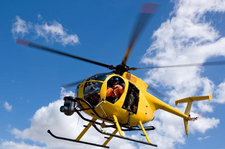
A low-flying helicopter will be documenting changes to Puna’s landscape from last year’s eruption of Kilauea volcano.
According to a U.S. Geological Survey, the flights will take eight to 10 days, scheduled between June 13 and 30, weather permitting.
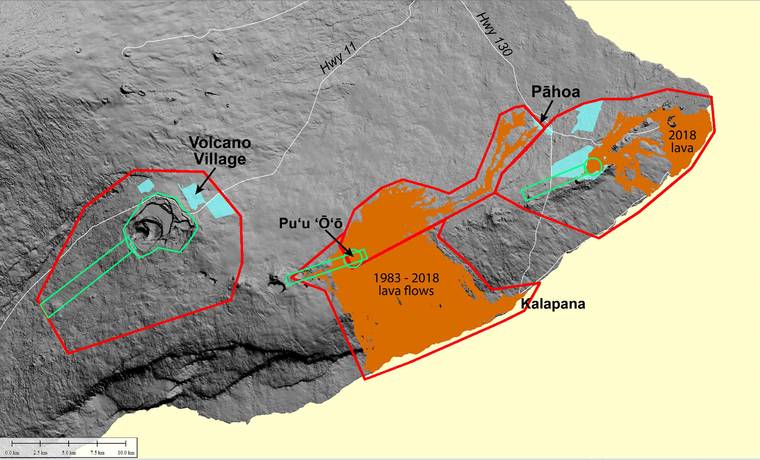
The survey, which will concentrate on the Kilauea summit and East Rift Zone areas, will use lidar — short for “light detection and ranging.”
“Our most recent lidar survey of the 2018 Puna lava flows and the summit area was flown in July 2018 before the eruption was finished. They were not able to fly through the massive plume from the ocean entries, so there is a large coverage gap in that area,” said Jim Kauahikaua, a Hawaiian Volcano Observatory geophysicist, on Monday in an email.
“The digital elevation models that we have been showing and using for calculation of flow thickness and volume and summit subsidence volume since the activity ceased were produced by a different method using drones that is reasonably accurate but is less accurate than lidar,” he said.
Windward Aviation, a Maui-based helicopter company, will conduct the survey under contract to Quantum Spatial. Experienced pilots, who are specially trained for low-level flying required for geophysical surveys, will operate the helicopter.
The company works with the Federal Aviation Administration to ensure flights are in accordance with U.S. law.
Residents should expect to see and hear a low-flying, bright yellow helicopter flying back and forth in a northeast-southwest direction over pre-planned flight lines.
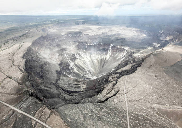
Most flights will be at an altitude of about 1,300 feet above ground level. However, in a few East Rift Zone areas, such as Leilani Estates, Ala‘ili Road, Pu‘u ‘O‘o, at the summit caldera and on the upper Southwest Rift Zone, flights will be at an altitude of 500 feet above ground level.
During the survey, the USGS asks residents for patience and understanding regarding helicopter noise during what they describe as an important survey.
Data acquired during the survey will enable scientists to model where new lava flows might travel if renewed volcanic activity occurs in the lower East Rift Zone.
From an emergency management perspective, having accurate elevation models was crucial during the past two Kilauea eruption responses in 2014-15 and last year, the USGS said. The precision of the new lidar survey also will improve the accuracy of earlier data sets which support ongoing scientific studies of past eruptions.
“We will be able to more accurately calculate flow thickness which, in turn, will help us estimate internal temperatures in the event the county or others want to start excavating or drilling into the 2018 lava,” Kauahikaua said. “Detailed topography of the flows will aid recovery planning of roads and other developments. Detailed topography and crack maps will help us improve our hazard assessments in the surveyed areas.
“This will be used for hazard mitigation planning to keep communities safe.”
Kauahikaua said lidar offers scientists “the possibility of stripping off the vegetation to glimpse the geologic structure underneath.”
“We will still map areas from the ground, but having lidar coverage will allow us to focus our energies on areas of the most interest,” he said. “… Having both lidar and extensive digital imagery of the 2018 lava flows will really help us decipher the lava flow structures that developed during the eruption. This in turn will help us understand similar future eruptions.”
Data collected during this survey will be used by USGS scientists to produce a digital elevation model from which the volumes of erupted lava and summit subsidence in 2018 can be calculated.
Products from the survey should be publicly available by late 2019.
Email John Burnett at jburnett@hawaiitribune-herald.com.