Forecasters track 3 tropical storms in Eastern Pacific
Three named storms are now lurking in the Eastern Pacific.
Kiko weakened from a Category 2 hurricane into a tropical storm, but it is expected to restrengthen into a hurricane, perhaps twice, by Sunday.
ADVERTISING
In addition, two tropical storms — Mario and Lorena — formed closer to Mexico, with Mario forecast to become a hurricane.
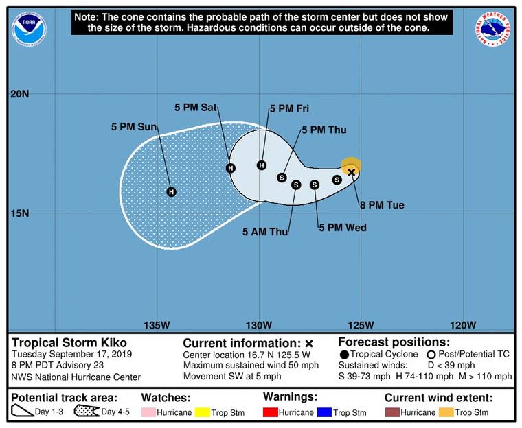
As of 5 p.m. Tuesday, the center of Kiko was 1,945 miles east of Hilo. The storm was packing maximum sustained winds of 50 mph and moving to the southwest at about 5 mph.
Kiko, which has taken twists and turns during the past several days, is expected to take a westward turn today and a west-northwestward motion Thursday into Friday. Maximum sustained winds decreased to near 60 mph, with higher gusts. Little change in strength is anticipated for the next day or so, but after that time Kiko could gradually restrengthen into a hurricane by Friday.
Tropical storm force winds extended outward up to 45 miles from the center.
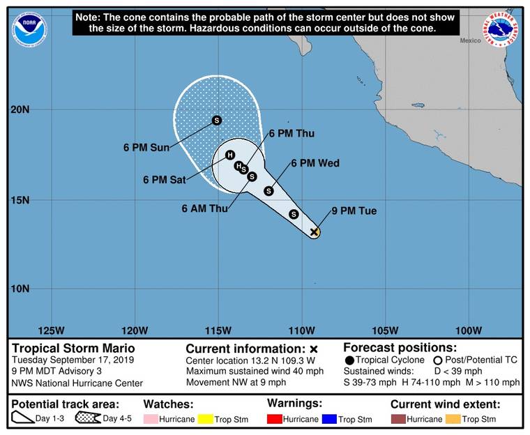
As of 5 p.m. Tuesday, the center of Tropical Storm Mario was about 670 miles south of the southern tip of Mexico’s Baja California Peninsula. Maximum sustained winds were 40 mph, and the storm was moving northwesterly at 9 mph.
According to forecasters at the National Hurricane Center in Miami, Mario’s general path is anticipated to remain stable for the next couple of days, with a turn to the west-northwest forecast on Friday. Gradual strengthening is forecast, and Mario could become a hurricane by Friday as it moves toward Hawaii.
Tropical storm force winds extend outward up to 25 miles from the center.
Tropical Storm Lorena is churning off the southern coast of Mexico, with maximum sustained winds of 50 mph. The forecast track is expected to take it up the southwest coast of Mexico, with a tropical storm warning in effect for that area.
Meanwhile, closer to home, forecasters at the Central Pacific Hurricane Center are tracking three disturbances that have not organized into tropical cyclones.
One, described as “an elongated area of low pressure” was about 700 miles southeast of the Big Island.
According to forecasters, the chance of the disturbance organizing into a tropical cyclone in the next five days was forecast as low, about 20%.
“Slow development is possible during the next several days while the area slowly moves westward, though the environmental conditions are only marginally favorable,” the forecast stated.
There are two other areas of low pressure, one about 450 miles southwest of Honolulu, the other about 950 miles west-southwest of Kauai.
Forecasters say the one closer to Honolulu has about a 50% chance of forming into a tropical cyclone.
The one closer to Kauai, according to forecasters, is less likely to organize into a tropical cyclone.
Neither system is expected to affect weather in populated areas of the state. Both, however, are expected “to bring locally gusty winds and heavy rain to portions of the Papahanaumokuakea Marine National Monument over the next several days,” forecasters wrote.
The national monument in the Northwest Hawaiian Islands, according to its website, is “the largest contiguous fully protected conservation area under the U.S. flag, and one of the largest marine conservation areas in the world.”
Email John Burnett at jburnett@hawaiitribune-herald.com.
